In a previous post we discussed how GPS technology has improved the accuracy and quality of current soil testing practices (link). The ability to pull and group cores from specific areas in a field has allowed us to deal with variability on a whole new level. As the size of farms and fields keep growing in Canada, we are dealing with variability on an ever increasing scale.
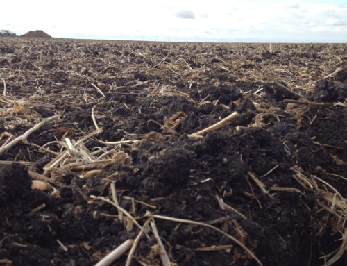
 Few fields are uniform from one corner to the other. Field variability exists as a result of many factors, both natural and man made. Some of the most influential factors include soil texture, topography, water and organic matter amongst others. GPS technology has given us the tools necessary to measure this variability and also the tools to address it.
One way to address field variability is to break a field into smaller management zones by grouping similar areas together based on productivity. These management zones are designed using a combination of information collected from a variety of sources. Typical sources include yield maps, satellite imagery, electrical conductivity, topography, grid sampling, soil texture, etc. Not to be overlooked is the producer’s knowledge of the field.
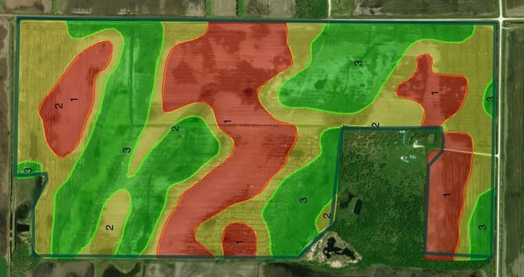
Electrical Conductivity based zone map on sandy soils
Water has played a major role in the development of our soils over the last 10,000 years and continues to play a major role in the variability we see today. At the risk of oversimplifying things, depressions hold water that in turn slowly percolates into the soil. This carries nutrients deeper into the soil profile, resulting in a more developed topsoil layer. The depressions grow more plant material, therefore are usually a lot higher in organic matter and nutrient supplying capacity. Conversely, ridges shed water resulting in a thinner topsoil layer. From a plant perspective, less water = less plant growth above and below ground. Of course, we all know that too much of a good thing isn’t always better.
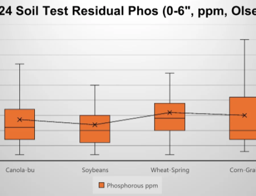
Armed with the right information, we can determine how to best address the variability in each zone by either trying to boost yields and/or cut costs. Zone soil sampling can help fine tune fertility programs for specific areas. It can also identify differences in the nutrient supplying capability of the soil, residual nutrient levels, soil textures, salinity levels, pH and so on. Knowing these levels, we can better match yield goals and fertility plans to each zone’s potential. Of course we still have to factor the unpredictability of the weather into any decisions. Mother Nature doesn’t always co-operate.
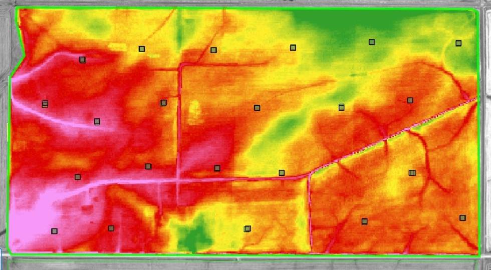
- Elevation Map based off LIDAR data collected by the Province of Manitoba. Pink represents low lying areas. Green is higher ground. Approximately 4ft difference in elevation.
In the Red River Valley, much of our variability can be attributed to topography and rainfall. Zone maps should begin with a good topography layer to identify areas that may be holding back water and areas that shed water readily. If you do not have good RTK elevation data available, the province has pretty good LIDAR data available for most of the Red River Valley and adjacent areas that you can work with as a starting point.
Zone management offers the potential to address field variability, thus improving yields and efficiencies. We have identified water and nutrient management as two key factors most producers should focus on. Antara has over 25 years of agronomy experience managing crops in the Red River Valley. Through on-farm research, we work directly with our clients and strive to improve their current production practices. For a variable rate program to be successful, we think it needs to be watched closely with “boots on the ground” throughout the growing season to properly assess the impact of all decisions.
Do you think there is room for improvement in your current farming practices? If so, we would like to hear from you. Leave a comment below. Contact Antara today to learn more about our approach to variable rate and our on-farm research network. We are currently booking soil sampling acres for the upcoming season in South Central and Eastern Manitoba.
Call Today!